The Iowa Environmental Mesonet (IEM) collects environmental data from cooperating members with observing networks. The data are stored and made available on this website.

End of 2026 Growing Season
Posted: 16 Nov 2026 05:30 AM, Views: 515
Previous Years' Features

7 Oct NWS Data Outage [resolved]
Posted: 7 Oct 9:36 AM
8 Oct Partial Outage [resolved]
Posted: 6 Oct 1:26 PM
5 Sep NWS Data Outage
Posted: 5 Sep 2:03 PM
4 Sep ISU Network Issue [resolved]
Posted: 4 Sep 11:03 AM
12 Aug Service Degradation [resolved]
Posted: 12 Aug 6:13 AM
Sign up for the Daily Bulletin
Soil Temperatures
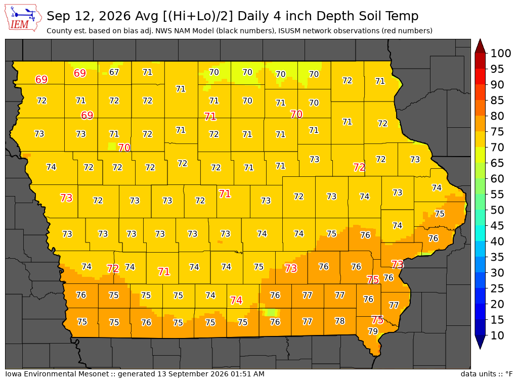
Data from the Iowa State Soil Moisture Network is found on this website and daily soil temperature averages are used to produce the highlighted analysis.

Current Data

The IEM combines data from participating networks into products like maps shown above and web applications to analyze the data.