Busy June Day
Posted:
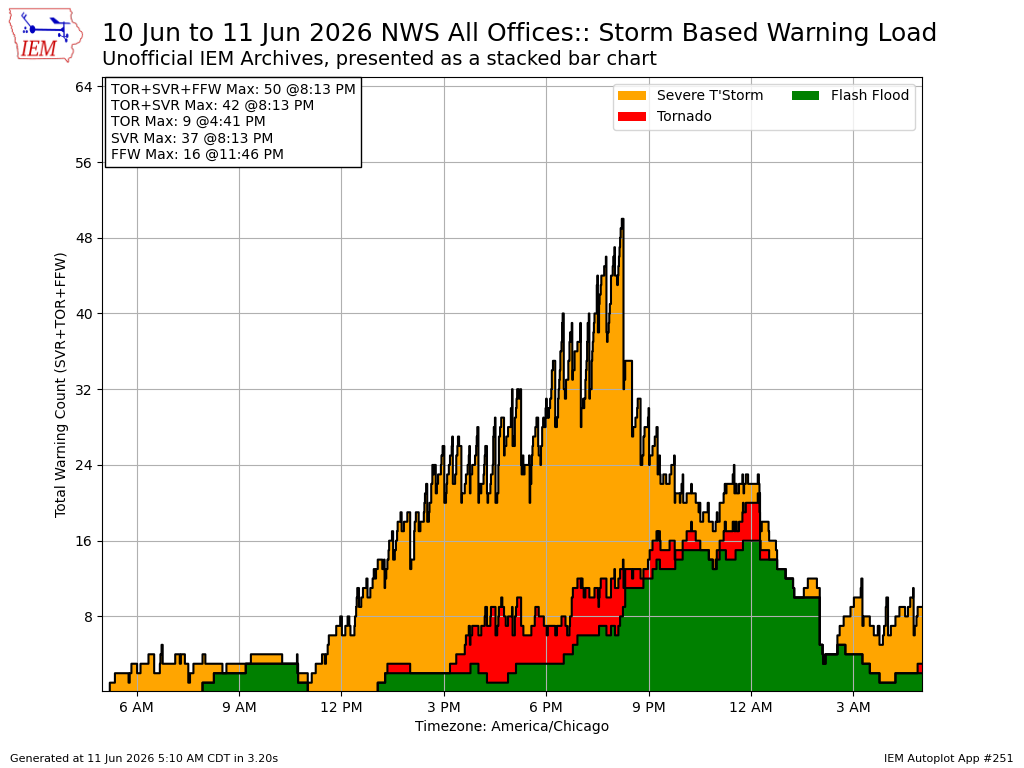
Multiple rounds of severe weather impacted Iowa and beyond on Wednesday with more severe weather expected today. The featured chart presents the number active Severe Thunderstorm, Tornado, and Flash Flood Warnings issued by the National Weather Service by minute between 5 AM yesterday morning till this morning. The data is presented as a stacked bar chart. The chart shows a typical severe weather life cycle with warnings first dominated by Severe Thunderstorm Warnings with a few Tornado warnings coming a bit later and then a transition to mostly Flash Flood Warnings as the accumulated effect of heavy rainfall associated with the storms produces flash flooding. Two rounds of rough weather are expected for Iowa today with the first already ongoing over southeastern Nebraska and southwestern Iowa, which will lift northeast. A second round is expected to fire early afternoon along a front that will sweep the state.
Voting:
Good = 17
Bad = 0
Voting:
Good = 17
Bad = 0